A
- Agrometeorology: The study of weather and climate and their effects on agriculture.
- Albedo: The fraction of solar energy reflected from the Earth back into space.
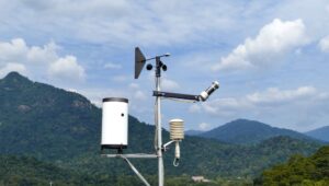
- Anemometer: An instrument used to measure wind speed.
- Atmospheric Pressure: The force exerted onto a surface by the weight of the air above that surface.
- Aridity Index: A numerical indicator of the degree of dryness of the climate at a given location.
- Agricultural Drought: A period where soil moisture is insufficient to meet the needs of a particular crop at a particular time, resulting in crop stress and reduced yield.
- Aerobiology: The study of airborne organic particles, such as pollen, which are relevant to plant reproduction and crop yields.
- Abscission: The natural detachment of parts of a plant, typically at the end of the growing season.
- Advection: The horizontal movement of air or water that can carry heat, moisture, or other atmospheric properties.
- Agroclimatology: The branch of climatology that studies the climatic conditions optimal for agriculture.
B
- Biometeorology: The study of the interaction between living organisms and climatic conditions.
- Biosphere: The global ecological system integrating all living beings and their relationships.
- Barometer: An instrument measuring atmospheric pressure, used in weather forecasting.
- Boreal: Relating to or characteristic of the cold climates of the northern regions.
- Biomass: The total mass of organisms in a given area or volume.
- Budburst: The beginning of growth from a bud in plants as a response to climatic conditions.
- Buffer Strips: Strips of vegetation are planted between crops and streams to capture farm runoff.
- Base Temperature: The lowest temperature at which a particular plant species will grow.
- Bioclimatology: The study of the effects of climatic conditions on living organisms.
- Blizzard: A severe snowstorm characterized by strong sustained winds of 35 mph or more and lasting for a prolonged period.
C
- Climatology: The study of climate, scientifically defined as weather conditions averaged over time.
- Canopy: The upper layer or habitat zone, formed by mature tree crowns and including other biological organisms.
- Chlorophyll: A green pigment responsible for the absorption of light to provide energy for photosynthesis.
- Condensation: The process by which water vapor in the air is changed into liquid water.
- Crop Yield: The total production of a crop per unit of land area.
- Climatic Zones: Divisions of the Earth’s climates into general zones according to average temperatures and average rainfall.
- Crop Coefficient: A factor used in calculating the water requirements of plants and crops.
- Convection: The vertical transport of heat and moisture in the atmosphere.
- Carbon Cycle: The series of processes by which carbon compounds are interconverted in the environment.
- Cold Front: The leading edge of a cooler mass of air, replacing (at ground level) a warmer mass of air.
D
- Dew Point: The atmospheric temperature below which water droplets begin to condense and dew can form.
- Drought: An extended period of deficient rainfall relative to the statistical multi-year average for a region.
- Drainage Basin: An area of land where precipitation collects and drains off into a common outlet.
- Diurnal Temperature Variation: The variation between a high temperature and a low temperature that occurs during the same day.
- Dendrochronology: The scientific method of dating based on the analysis of patterns of tree rings.
- Dew: Tiny drops of water that form on cool surfaces at night, when atmospheric vapor condenses.
- Delta: A landform at the mouth of a river where it splits into several outlets.
- Downburst: A strong ground-level wind system that emanates from a point above and blows radially.
- Doppler Radar: A radar tracking system that uses the Doppler effect to measure an object’s velocity.
- Deciduous: Plants that lose their leaves for part of the year.
E
- Evapotranspiration: The process by which water is transferred from the land to the atmosphere by evaporation from soil and other surfaces and by transpiration from plants.
- El Niño: A climate pattern that describes the unusual warming of surface waters in the eastern tropical Pacific Ocean, influencing global weather patterns.
- Ecosystem: A community of living organisms in conjunction with the nonliving components of their environment, interacting as a system.
- Equinox: The time or date at which the sun crosses the celestial equator when day and night are of approximately equal length.
- Erosion: The process by which soil and rock are removed from the Earth’s surface by natural processes such as wind or water flow.
- Eddy: A small disturbance of wind in a large stream of air.
- Endemic: A species or condition found among particular people or in a certain area.
- Enthalpy: A measurement of energy in a thermodynamic system. It is used to express the total heat content of a system.
- Ephemeral: Lasting for a very short time; used to describe streams or plants that only exist for a brief period.
- Ecology: The branch of biology that deals with the relations of organisms to one another and to their physical surroundings.
F
- Frost: The coating or deposit of ice that may form in humid air in cold conditions, usually overnight.
- Front: A boundary separating two masses of air of different densities, and is the principal cause of meteorological phenomena.
- Fog: A thick cloud of tiny water droplets suspended in the atmosphere at or near the earth’s surface that obscures or restricts visibility.
- Fahrenheit: A temperature scale on which water freezes at 32 degrees and boils at 212 degrees under standard conditions.
- Flora: The plants of a particular region, habitat, or geological period.
- Fertilization: The process of adding nutrients to the soil to enhance the growth of plants.
- Fetch: The area of water over which a given wind has blown.
- Fallow: Farmland plowed and harrowed but left unsown for a period in order to restore its fertility as part of a crop rotation or to avoid surplus production.
- Fen: A type of wetland fed by mineral-rich surface water or groundwater.
- Forage: The search for wild food resources. It can also refer to the type of plant material (grass or tree leaves) farmed animals eat to gain energy and nutrients.
G
- Growing Season: The part of the year during which local weather conditions (temperature and rainfall) permit normal plant growth.
- Greenhouse Effect: The trapping of the sun’s warmth in a planet’s lower atmosphere due to the greater transparency of the atmosphere to visible radiation from the sun than to infrared radiation emitted from the planet’s surface.
- Gust: A brief increase in the speed of the wind, usually for twenty seconds or less.
- Geomorphology: The study of the physical features of the surface of the earth and their relation to its geological structures.
- Germination: The process by which a plant grows from a seed.
- Gibberellin: A plant hormone that promotes growth and elongation of cells.
- Gully: A water-worn ravine.
- Grain: The seeds of various cereal grasses, such as wheat, corn, and rice, which are used as food.
- Gradient: A rate of inclination; a slope.
- Geostationary: Refers to a satellite that remains in the same position relative to the earth’s surface.
H
- Humidity: The amount of water vapor present in the air.
- Hydrology: The scientific study of the movement, distribution, and quality of water on Earth.
- Hail: Precipitation of ice pellets when there are strong rising air currents.
- Horizon: The line at which the earth’s surface and the sky appear to meet.
- Horticulture: The art or practice of garden cultivation and management.
- Hygrometer: An instrument used to measure the moisture content in the atmosphere.
- Hardiness Zone: A geographically defined area in which a specific category of plant life is capable of growing, as defined by climatic conditions, including its ability to withstand the minimum temperatures of the zone.
- Heat Wave: A prolonged period of excessively hot weather, which may be accompanied by high humidity.
- Hydroponics: A method of growing plants without soil by using mineral nutrient solutions in a water solvent.
- Hypsometer: An instrument used to measure height or altitude in meteorological and other surveys.
I
- Insolation: The amount of solar radiation reaching a given area.
- Irrigation: The artificial application of water to the land or soil to assist in the growing of crops.
- Inversion: A meteorological condition in which the temperature increases with increasing altitude, contrary to the norm, which can trap pollutants.
- Isotherm: A line on a map connecting points having the same temperature at the same time or on average over a given period.
- Iceberg: A large piece of freshwater ice that has broken off a glacier or an ice shelf and is floating freely in open water.
- Interception: The precipitation that does not reach the soil, but is instead intercepted by the leaves, branches of plants, and the forest floor.
- Inflorescence: The complete flower head of a plant including stems, stalks, bracts, and flowers.
- Infiltration: The process by which water on the ground surface enters the soil.
- Irradiance: The power of electromagnetic radiation per unit area (radiative flux) incident on a surface.
- Isobar: A line on a map connecting points of equal atmospheric pressure.
J
- Jet Stream: Fast-flowing, narrow air currents found in the atmospheres of some planets, including Earth.
- Joule: A unit of energy in the International System of Units. It is equal to the energy transferred to an object when the force of one Newton acts on that object in the direction of the force’s motion through a distance of one meter.
- Julian Date: The continuous count of days since the beginning of the Julian Period used primarily by astronomers.
- Juxtaposition: The fact of two things being seen or placed close together with contrasting effects, useful in comparing different meteorological phenomena.
- Jovian: Of Jupiter; by extension, characteristics of the outer planets of the solar system.
- Juvenile Water: Primary water that has never been part of the global water cycle and is often released from deep within the earth during volcanic activities.
- Jumping Gene: A segment of DNA that can move or “jump” from one location in the genome to another, often used in genetic studies of plant populations.
- Jetty: A structure that projects from the land out into the water, often used to influence currents and tides.
- Juglone: A natural substance found in walnuts that is toxic to some plants, affecting their ability to grow nearby.
- Jade Plant: Commonly known as a houseplant, but relevant in studies of indoor air quality and its improvement.
K
- Katabatic Wind: A wind that carries high-density air from a higher elevation down a slope under the force of gravity; often occurs at night.
- Köppen Climate Classification: A widely used climate classification system that divides climates into five main groups, based on the annual and monthly averages of temperature and precipitation.
- Kilometer: A unit of length in the metric system, equal to one thousand meters, commonly used in geographical measurements.
- Kinetic Energy: The energy that an object possesses due to its motion, important in the study of atmospheric dynamics.
- Karyotype: The number and visual appearance of the chromosomes in the cell nuclei of an organism or species, used in genetic studies of plant species.
- Kelp: Large seaweeds belonging to the brown algae family, which are important in marine ecosystems and can be affected by ocean temperatures.
- Keystone Species: A species on which other species in an ecosystem largely depend, such that if it were removed the ecosystem would change drastically.
- Knoll: A small, rounded hill or mound, often used in topographical descriptions in agrometeorology.
- Knot: A unit of speed equal to one nautical mile per hour, used in meteorological reports for wind speed.
- Kyoto Protocol: An international treaty that commits state parties to reduce greenhouse gas emissions, based on the premise that global warming exists and human-made CO2 emissions have caused it.
L
- Lapse Rate: The rate at which air temperature falls with increasing altitude.
- Latent Heat: The heat required to convert a solid into a liquid or vapor, or a liquid into a vapor, without change of temperature, which plays a crucial role in the formation of weather patterns.
- Leeward: The direction downwind from a point of reference, used to describe the side of a mountain or hill sheltered from the wind.
- Loam: A rich, fertile soil that is a mix of sand, silt, and clay, considered ideal for growing many types of crops.
- Lithosphere: The rigid outer part of the earth, consisting of the crust and upper mantle, relevant in studies of soil and terrain.
- Longitudinal Wave: A wave vibrating in the direction of propagation, as in sound waves, relevant in studies of soil dynamics and earthquakes.
- Lenticular Cloud: A lens-shaped cloud that normally develops on the downwind side of a mountain or mountain range, an indicator of atmospheric stability and wind patterns.
- Leaching: The process by which soluble substances are washed out of soil by downward percolating water.
- Luminosity: The intrinsic brightness of a celestial object, used in climatology to describe solar radiation.
- Lagoon: A shallow body of water separated from a larger body of water by barrier islands or reefs, impacted by changes in sea level and climate.
M
- Meteorology: The science that deals with the phenomena of the atmosphere, especially weather and weather conditions.
- Microclimate: The climate of a very small or restricted area, especially when this differs from the climate of the surrounding area.
- Mesosphere: The layer of the Earth’s atmosphere that is directly above the stratosphere and below the thermosphere.
- Monsoon: A seasonal prevailing wind in the region of South and Southeast Asia, which brings about significant changes in the weather.
- Mist: A cloud of tiny water droplets suspended in the atmosphere at or near the earth’s surface that limits visibility.
- Macronutrient: A type of nutrient that organisms need in relatively large amounts to survive, including carbon, hydrogen, and oxygen.
- Mulch: A layer of material applied to the surface of the soil to conserve moisture, improve fertility and health of the soil, reduce weed growth, and enhance visual appeal.
- Meridian: A circle of constant longitude passing through a given place on the earth’s surface and the terrestrial poles.
- Meteosat: A series of meteorological satellites operated by the European Organisation for the Exploitation of Meteorological Satellites.
- Mycorrhiza: A fungus that grows in association with the roots of a plant in a symbiotic or mildly pathogenic relationship.
N
- Nimbostratus: A type of cloud forming a thick uniform layer at low altitude, generally capable of producing precipitation.
- Nitrogen Cycle: The series of processes by which nitrogen and its compounds are interconverted in the environment and in living organisms.
- Noctilucent Clouds: Clouds that are visible at a very high altitude, glowing at night well after sunset.
- Nephology: The study of clouds and cloud formation.
- Nucleation: The process by which a small number of ions, molecules, or particles in the atmosphere become the core for the formation of larger particles or droplets.
- Nor’easter: A macro-scale storm along the East Coast of the United States and Atlantic Canada; it gets its name from the direction of the strongest winds that will be hitting the coast.
- Neap Tide: A tide just after the first or third quarters of the moon when there is the least difference between high and low water.
- Net Radiation: The balance between incoming and outgoing energy at the top of the atmosphere.
- Nyctinasty: The movement of plants in response to the onset of darkness (e.g., the closing of the leaves of a Mimosa plant).
- Nadir: The point on the celestial sphere directly below an observer, or the lowest point in a particular sphere or orbit.
O
- Orographic Lift: The elevation of air caused by its passage over a mountain, which can lead to cloud formation and precipitation.
- Ozone Layer: A layer in the earth’s stratosphere containing a high concentration of ozone, which absorbs most of the sun’s ultraviolet radiation.
- Osmosis: The movement of water molecules through a semipermeable membrane from an area of lower solute concentration to an area of higher solute concentration.
- Outgassing: The release of a gas that was dissolved, trapped, frozen, or absorbed in some material; often refers to the release of gases from the interior of the Earth to the atmosphere.
- Occluded Front: A weather front formed during the process of cyclogenesis when a cold front overtakes a warm front, lifting the warm air mass off the ground.
- Ocean Currents: Large-scale movements of waters in the ocean such as the Gulf Stream, which distribute thermal energy across the surface of the earth.
- Organic Matter: Plant and animal residues, or substances made by living organisms, all in various stages of decomposition.
- Overshoot: Exceeding a sustainable limit or capacity, often used in the context of population dynamics or resource usage.
- Optimal Foraging Theory: A model that helps predict how an animal behaves when searching for food.
- Ombrothermic Diagram: A graphical representation of climatic data that shows the relationship between precipitation and temperature throughout the year.
P
- Photosynthesis: The process by which green plants and some other organisms use sunlight to synthesize nutrients from carbon dioxide and water.
- Precipitation: Any form of water – liquid or solid – falling from the sky, including rain, snow, sleet, and hail.
- Permafrost: Permanently frozen layer below the Earth’s surface consisting of soil, gravel, and sand, typically bound together by ice.
- Phenology: The study of cyclic and seasonal natural phenomena, especially about climate and plant and animal life.
- Pyranometer: An instrument used to measure solar radiation on a plane surface, typically used in meteorological stations to measure the intensity of incident solar radiation.
- Pluviometer: Another term for a rain gauge, an instrument used to gather and measure the amount of liquid precipitation over a set period.
- Polar Vortex: A large area of low pressure and cold air surrounding both of the Earth’s poles, which strengthens in the winter and weakens in the summer.
- Palynology: The study of dust and pollen grains and spores, especially as it relates to historical climatology, archaeology, and paleontology.
- Psychrometer: An instrument used to measure the relative humidity of the atmosphere through the wet and dry bulb temperatures.
- Pan Evaporation: A measure of the evaporation rate of water into the atmosphere from a standard-sized pan, used to estimate the evaporation rate of an open water body.
Q
- Quasi-Biennial Oscillation (QBO): A quasi-periodic oscillation of the equatorial zonal wind between easterlies and westerlies in the tropical stratosphere.
- Quantitative Precipitation Forecast (QPF): An estimate of the amount of precipitation expected at a specific location during a specified forecast period.
- Quantum Sensor: A device used to measure photosynthetically active radiation (PAR) in plant canopies.
- Quadrantid Meteor Shower: An annual meteor shower that peaks around early January, named after the constellation Quadrans Muralis.
- Quasi-Stationary Front: A weather front that moves very slowly or not at all, leading to prolonged weather conditions.
- Quartz Psychrometer: A type of psychrometer, which uses quartz crystals to measure humidity through changes in frequency.
- Qanat: A traditional system of underground canals used in the Middle East and North Africa for irrigation.
- Quagmire: Land that is extremely wet and boggy, making it difficult to traverse and often unsuitable for standard agricultural practices.
- Quercus: The botanical genus for oaks, is significant in studies of vegetation and climate interactions due to their widespread presence and ecological importance.
- Quenching: In meteorology, refers to the process where rain falls through a layer of warm air but is cooled by the underlying cold layer, affecting storm dynamics.
R
- Radiation: The emission or transmission of energy in the form of waves or particles through space or through a material medium.
- Relative Humidity: The amount of water vapor present in air expressed as a percentage of the amount needed for saturation at the same temperature.
- Rossby Waves: Large-scale meanders in high-altitude winds that are a major influence on weather.
- Rain Gauge: An instrument used to collect and measure the amount of liquid precipitation over a set period.
- Rime: Frost formed on cold objects by the rapid freezing of water vapor in cloud or fog.
- Respiration: The process by which living organisms take in oxygen and release carbon dioxide, fundamental in carbon cycling.
- Rhizome: A continuously growing horizontal underground stem that puts out lateral shoots and adventitious roots at intervals.
- Radiosonde: An instrument carried into the atmosphere by a balloon, collecting data about pressure, temperature, and humidity.
- Runoff: Water that flows over the ground surface or through the soil on its way to a stream, river, or other body of water.
- Refraction: The bending of light or sound waves due to a change in their speed when they pass from one medium to another.
S
- Stratosphere: The second major layer of Earth’s atmosphere, just above the troposphere and below the mesosphere.
- Solstice: Either of the two times in the year, the summer solstice and the winter solstice, when the sun reaches its highest or lowest point in the sky at noon, marked by the longest and shortest days.
- Synoptic Scale: A large-scale meteorological pattern involving broad systems such as high-pressure systems and storms.
- Sleet: Form of precipitation consisting of ice pellets, often mixed with rain or snow.
- Saturation: The state or process that occurs when no more of something can be absorbed, combined with, or added.
- Sublimation: The transition of a substance directly from the solid to the gas phase without passing through the intermediate liquid phase.
- Scud: Low, ragged clouds that are often seen beneath storm clouds and can indicate turbulent weather.
- Snow Gauge: An instrument used to collect and measure the amount of snowfall.
- Sodic Soil: Soil that has high levels of sodium, often causing poor structure and drainage, limiting its agricultural use.
- Stomata: Small openings on the surface of leaves that allow the exchange of gases (carbon dioxide, water vapor) between the plant and the atmosphere.
T
- Troposphere: The lowest layer of Earth’s atmosphere, where most weather phenomena occur.
- Thermocline: A thin but distinct layer in a large body of fluid, such as water, in which temperature changes more rapidly with depth than it does in the layers above or below.
- Transpiration: The process by which moisture is carried through plants from roots to small pores on the underside of leaves, where it changes to vapor and is released into the atmosphere.
- Typhoon: A mature tropical cyclone that develops in the western part of the North Pacific Ocean.
- Tornado: A violently rotating column of air touching the ground, usually attached to the base of a thunderstorm.
- Thermometer: An instrument for measuring and indicating temperature.
- Topography: The arrangement of the natural and artificial physical features of an area.
- Trace Gas: Gases that make up less than 1% of the Earth’s atmosphere, including all gases except nitrogen and oxygen.
- Turbulence: Violent or unsteady movement of air or water, or of some other fluid.
- Tundra: A vast, flat, treeless Arctic region in which the subsoil is permanently frozen.
U
- Ultraviolet Radiation (UV): Electromagnetic radiation with a wavelength shorter than that of visible light, but longer than X-rays.
- Upwelling: A process in which deep, cold water rises toward the surface, rich in nutrients and playing a significant role in ocean productivity.
- Urban Heat Island (UHI): An urban area or metropolitan area that is significantly warmer than its surrounding rural areas due to human activities.
- Unstable Atmosphere: Atmospheric conditions where air is prone to upward movement, which can lead to the development of thunderstorms and other types of severe weather.
- Understory: A layer of vegetation beneath the main canopy of a forest.
- Umbra: The fully shaded inner region of a shadow caused by the complete obstruction of light.
- Utility Fog: A hypothetical collection of tiny robots that can replicate a physical structure through large-scale swarming.
- Upper-Air Wind: Winds that are located in the upper part of the atmosphere, typically measured via weather balloons or aircraft.
- Uplift: The vertical ascent of air in the atmosphere, which can lead to cloud formation and precipitation.
- Uranography: The study of the heavens and the mapping of the stars, an ancient precursor to modern astronomy.
V
- Vapor Pressure: The pressure of a vapor in thermodynamic equilibrium with its condensed phases at a given temperature in a closed system.
- Vernal Equinox: The equinox in spring, on about March 20 in the northern hemisphere and September 22 in the southern hemisphere, when day and night are of equal length.
- Virga: Rain that falls from a cloud but evaporates before it reaches the ground.
- Vortex: A region within a fluid where the flow revolves around an axis line, which may be straight or curved.
- Volatility: The characteristic of a substance to vaporize at a relatively low temperature.
- Visibility: The measure of the distance at which an object or light can be discerned.
- Vegetative Propagation: A form of asexual reproduction in plants, where new plants grow from parts of the parent plant.
- Vaporization: The phase transition of a substance from liquid to gas.
- Variable Winds: Winds that blow from different directions and are common in areas where there are no prevailing winds.
- Van Allen Belts: Zones of charged particles trapped by Earth’s magnetic field, located above the atmosphere.
W
- Weathering: The breaking down or dissolving of rocks and minerals on Earth’s surface, which can be caused by weather conditions such as precipitation and temperature.
- Watershed: The land area that drains into a stream, river, or lake.
- Wind Shear: A sudden change in wind speed and/or direction over a short distance, often associated with turbulent weather.
- Westerlies: The prevailing winds that blow from the west in the middle latitudes between 30 and 60 degrees latitude.
- Wetland: An area of land saturated with water, either seasonally or permanently, which functions as its own distinct ecosystem.
- Weather Front: A boundary separating two masses of air of different densities, and is the principal cause of meteorological phenomena.
- Wind Vane: An instrument used to show the direction of the wind.
- Warm Front: The boundary of an advancing mass of warm air, in particular the leading edge of the warm sector of a low-pressure system.
- Wilting Point: The minimal point of soil moisture the plant requires not to wilt.
- Whirlwind: A small, rapidly rotating windstorm of a limited extent, ranging from a small dust devil to a tornado.
X
- Xerophyte: A species of plant that has adapted to survive in an environment with little liquid water, such as a desert.
- Xylem: The vascular tissue in plants that conducts water and dissolved nutrients upward from the root and also helps to form the woody element in the stem.
- Xenolith: A rock fragment that becomes enveloped in a larger rock during the latter’s development and hardening.
- Xanthophyll: Yellow pigments in leaves that cause the yellow colors seen in autumn foliage.
- Xeric: Characterizing an environment or habitat containing little moisture; very dry.
- X-band Radar: A type of radar that operates in the X-band frequency, used in various meteorological applications to track rain, snow, and other weather phenomena.
- Xenobiology: A form of biology that studies the hypothetical biological processes and beings that might occur outside of Earth or that utilizes synthetic biology to create alternative life forms.
- Xanthochroism: An abnormal yellow pigmentation of animals, which can be influenced by genetic mutations or environmental factors.
- Xylophagy: The practice of eating wood, found in various species, including some termites and beetles, is important in forest ecology.
- X-axis: In graphs that plot meteorological data, the x-axis typically represents time.
Y
- Yolk Sac: This little sac provides baby birds with their first nutrition until they hatch. Its importance shows how weather can affect breeding seasons.
- Yearly Weather Cycle: Each region sees changes throughout the seasons as temperatures and rainfall vary. Understanding these patterns helps farmers know what to plant and when.
- Yangtze River: One of China’s longest rivers, it brings water to huge swaths of land. However, too much or too little rainfall in its basin due to climate conditions can impact many people.
- Yucatan Peninsula: The limestone shelf in Mexico absorbs rainfall well. But during droughts, sinkholes may appear as rock dissolves underground from lack of water seeping in.
- Yellow Fever: This mosquito-borne disease often spreads more where it’s hot and wet. So climate influences outbreak risks in tropical places.
- Yeast: The microbes used to make bread and beer need certain moisture and temperature zones to thrive. Climate helps determine what foods can be produced locally.
- Yak: These long-haired cattle live at high elevations in the Himalayas. Their thick coats and fat help them survive in the region’s cold, windy weather.
- Yellowstone: This US national park sees many geological features like geysers and hot springs due to underground volcanic activity. The park’s climate and location allow these wonders to exist.
- Yucheng Catastrophe: In 1961, a drought struck northern China, leading to widespread crop failure. Over 15 million people were affected, showing how climate disasters impact people worldwide.
- Yangtze Delta: China’s most densely populated and economically important region relies on the rich soils deposited here by the Yangtze River over millennia. But risks like sea level rise and stronger storms threaten due to climate change.

